
Articles & Advice · 30 July 2026
GPS & Utility Mapping in Auckland: How Accurate Underground Mapping Keeps Projects on Track
Construction and infrastructure projects run on information as much as they run on materials and labour.
Construction and infrastructure projects run on information as much as they run on materials and labour. Knowing exactly where underground services sit — down to the centimetre — shapes everything from design decisions to construction sequencing. That's where GPS utility mapping comes in, turning what's buried and invisible into an accurate, usable record.
At Utility Works, we carry out GPS and utility mapping for developers, project managers, and civil contractors across Auckland. This guide explains how the process works and why it's become such a critical part of modern project planning.
What Is GPS Utility Mapping?
GPS utility mapping is the process of recording the precise location of underground services using survey-grade GPS technology, combined with detection methods like ground penetrating radar and cable locating. Instead of relying on old plans or estimates, this process produces an accurate digital record of exactly where pipes, cables, and ducts sit on a site.
This record typically includes:
- Horizontal position, so services can be located precisely on a plan
- Depth, where detection methods allow it to be measured accurately
- Service type, such as power, water, gas, or communications
- As-built documentation, for use in design, construction, and future maintenance
How the Process Works
GPS utility mapping combines detection technology with high-accuracy positioning. In practice, this usually looks like:
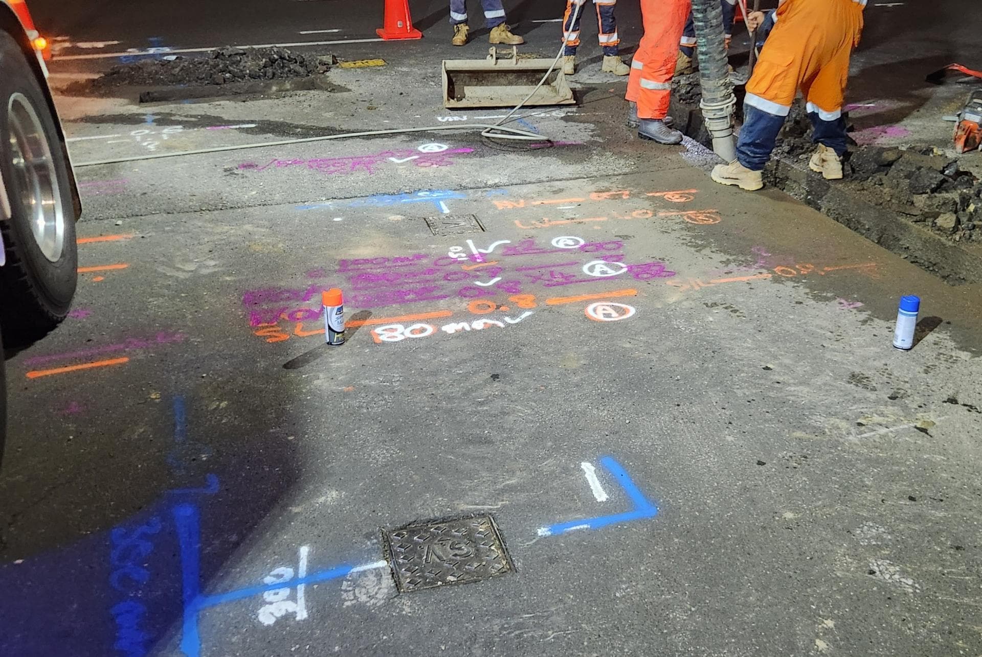
- Detecting services on site using ground penetrating radar, cable locators, and other subsurface detection tools
- Marking confirmed locations physically on the ground
- Capturing GPS coordinates at each marked point using survey-grade equipment
- Compiling the data into a digital plan or GIS-compatible file
- Delivering as-built records to the project team for design, consenting, or ongoing reference
The result is a mapped record that's precise enough to inform detailed design work, not just a rough guide for where not to dig.
Why Accuracy Matters on Construction Projects
A project team working from outdated or approximate service plans is working with more risk than they realise. Inaccurate records can lead to:
- Clashes during design, where new infrastructure is planned directly over an existing service
- Construction delays, when unmapped services are discovered mid-excavation
- Costly redesign, if services need to be relocated after construction has already started
- Compliance issues, where as-built records don't match what's actually in the ground
Accurate GPS utility mapping removes much of this risk before it becomes a problem on site, giving project managers and designers a reliable foundation to build on.
Where GPS Utility Mapping Fits Into a Project
GPS and utility mapping is useful at several stages of a project, not just before excavation begins:
- Early design and feasibility, to understand what's already in the ground before finalising layouts
- Consenting and compliance, where accurate service records may be required by council or network providers
- During construction, to confirm services match what was expected before work proceeds
- Post-construction, to produce updated as-built records reflecting any new infrastructure installed
For larger developments and subdivisions, mapping is often carried out at multiple stages to keep records current as the site changes.
Supporting Risk Reduction and Compliance
Beyond the practical value on site, accurate utility mapping plays a role in managing risk across a project. Clear, GPS-verified records give project teams confidence when reporting to councils, network providers, or clients, and provide a documented reference point if questions arise later about where services were located at the time of construction.
This is particularly valuable on projects with multiple stakeholders, where several parties need to work from the same accurate information rather than differing assumptions about what's underground.
Keep Your Project on Track With Accurate Mapping
Underground infrastructure doesn't announce itself, which is exactly why GPS utility mapping has become standard practice on well-run construction and infrastructure projects. It replaces guesswork with an accurate, usable record — protecting timelines, budgets, and safety along the way.
If you're planning a project anywhere in Auckland, Franklin, or North Waikato and need reliable underground service mapping, get in touch with the Utility Works team. Learn more about our GPS and utility mapping services.
Frequently Asked Questions
How does GPS utility mapping work?
GPS utility mapping combines detection methods, such as ground penetrating radar and cable locating, with survey-grade GPS positioning to record the precise location of underground services and compile them into an accurate digital plan.
Why is GPS utility mapping more reliable than existing service plans?
Existing plans can be outdated, incomplete, or based on approximate records. GPS utility mapping verifies actual conditions on site, capturing precise coordinates rather than relying on historical documentation alone.
When should GPS utility mapping be done on a project?
It's useful at multiple stages, including early design and feasibility, before construction begins, during works to confirm conditions, and after construction to update as-built records.
Can GPS utility mapping detect the depth of underground services?
In many cases, yes. Detection methods like ground penetrating radar can estimate depth alongside horizontal position, though accuracy can vary depending on ground conditions and service type.
Who typically needs GPS and utility mapping services?
Developers, civil contractors, project managers, and consultants working on construction, subdivision, or infrastructure projects commonly use GPS utility mapping to support design, compliance, and risk management.
Let's discuss your underground project needs. Contact us today for a free, no-obligation quote.
Free, no-obligation quote · Mon–Fri 7am–5pm · Auckland, Franklin & North Waikato