
Underground Service Locating in Drury
Local underground service locating for Drury and the wider Franklin & Pukekohe area
Since 2015Own locators, hydro-vac & diggersAuckland · Franklin · North Waikato
Leak detection and service detection jobs can start from $300 +GST. Every job is different, so call 0800 779 588 and we’ll talk through your situation and give you an estimate.
Underground Service Locating for Drury properties, sites and farms
On Drury's greenfield sites the services are new, which does not mean they are where the drawings say. Stages built in quick succession, with several contractors on the same block, often leave as-builts that disagree with the ground. Utility Works locates the new mains, laterals, ducts and cables on Drury sites and marks them with depth before footings, drainage or landscaping go in. On the established rural roads nearby we do the opposite job, finding old private lines that no plan has ever recorded.
Typical underground service locating jobs in Drury
- Verifying new subdivision services against as-builts before house construction starts
- Locating power, water and fibre on fresh lots before fences and retaining walls
- Finding unrecorded private lines on lifestyle blocks before new shed foundations
Underground Service Locating, in short
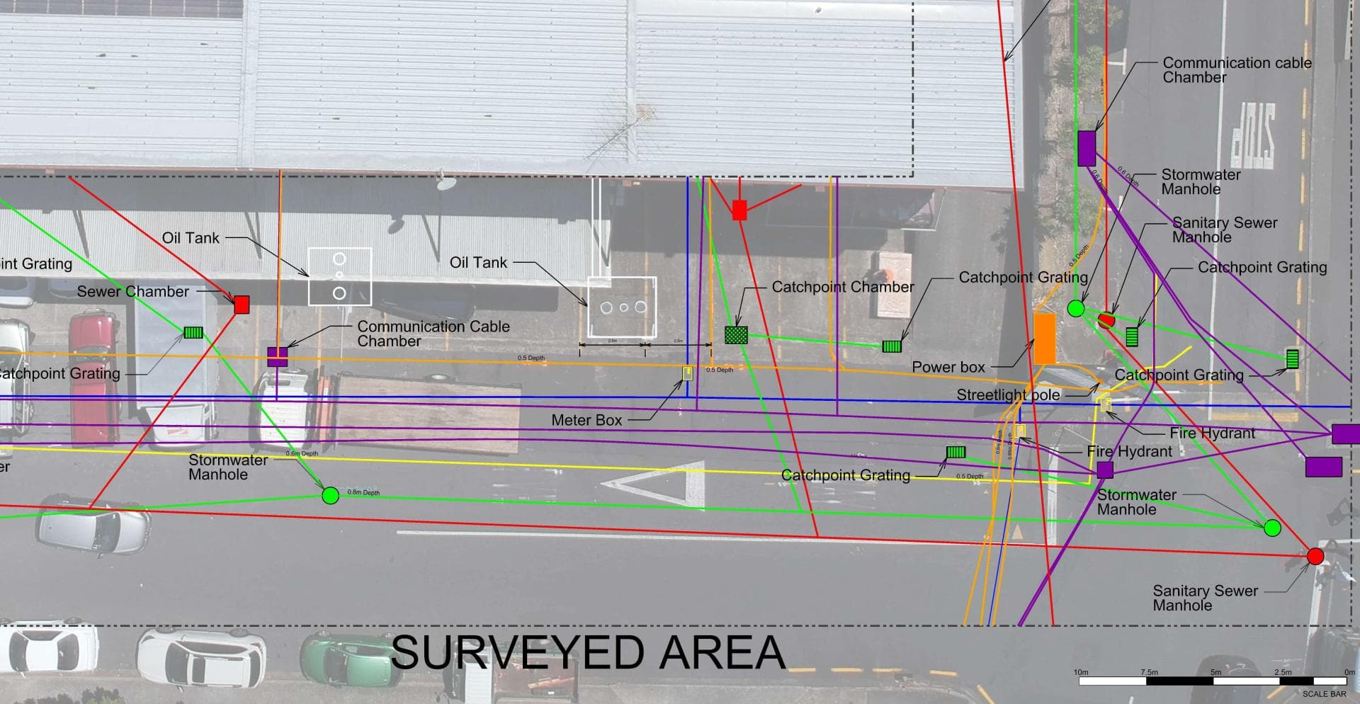
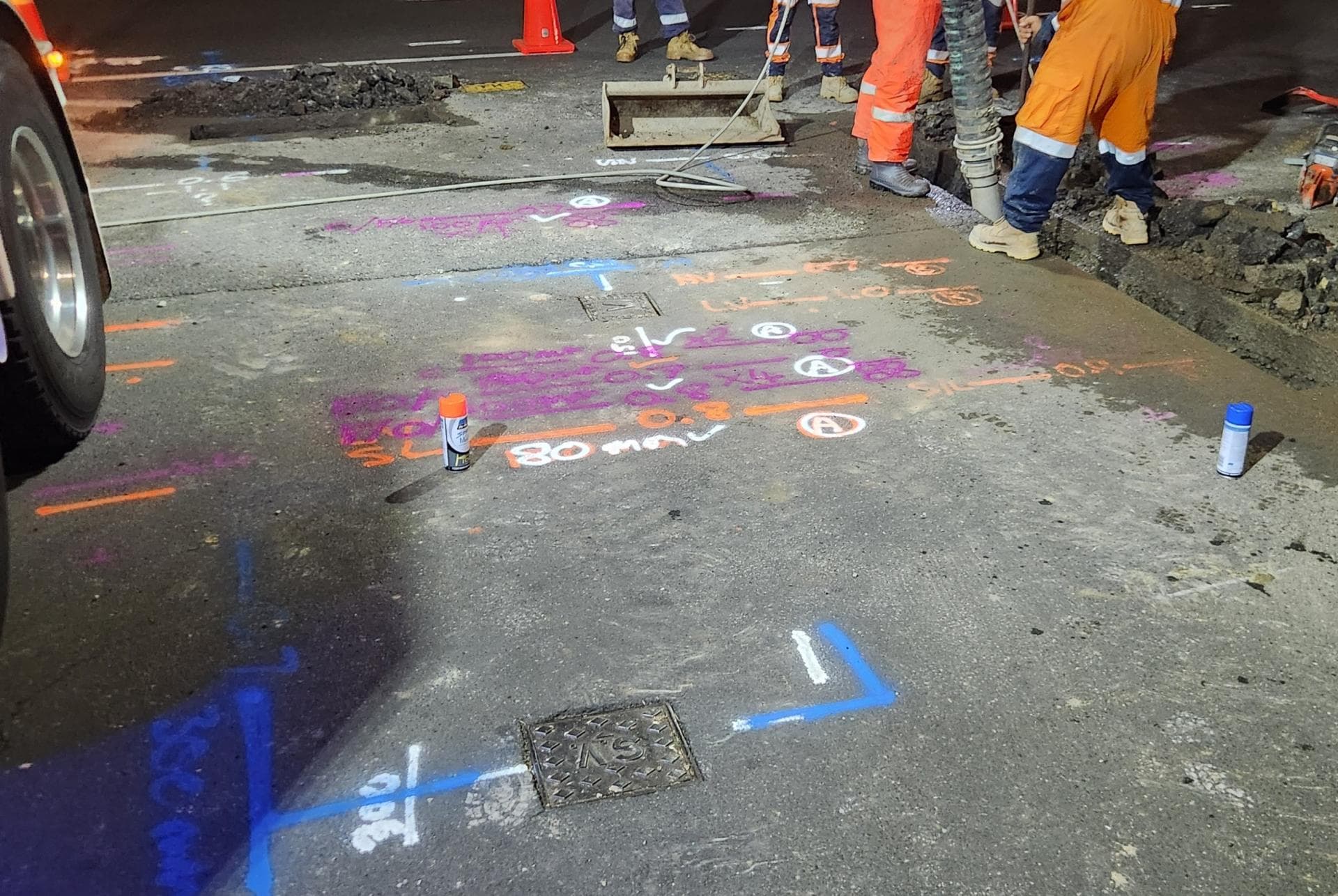
Before anyone digs, we find what is already in the ground: power cables, water and gas pipes, fibre and copper ducts, stormwater and sewer. Electromagnetic locators, tracer equipment, sonde-fitted cameras and ground penetrating radar each pick up what the others cannot, and we mark every service with its depth. Asset owners’ plans from beforeUdig are the starting point; the mark-out shows where things actually are. Where a service must be seen, our hydro-vac truck potholes it without damage, and if the job then needs trenching or a repair the same crew carries on. We can also record what we find with survey-grade GPS for plans and consents.
Full details: Service Location, Detection & Mapping →Working underground in Drury
Drury is changing faster than almost anywhere else in the region. Land that was dairy pasture and lifestyle blocks a few years ago is now being cut into residential lots, with new roads, water and wastewater mains going in to serve them, and more stages following behind.
The ground is largely clay-based, which is firm to work in dry weather but holds water and gets heavy once wet. On greenfield sites the challenge is usually knowing where the brand-new services were actually laid, as as-built drawings do not always match what is in the ground.
Established parts of Drury and the surrounding rural roads still run on older pipework, and lifestyle properties often have long private water lines feeding houses, sheds and troughs. Watercare supplies the reticulated areas; many rural properties remain on bores or tank supply.
When Drury’s homes were built, and what went in with them
The age of a house tells us what pipe and cable to expect underneath it before we arrive.
Before 1960
Drury began as a coal and brick village. Mining started in the 1850s, a tramway carried coal to Slippery Creek from 1862, and a brick and pottery works ran into the 1920s. The few genuinely old houses cluster around the village on Great South Road.
1960s to 1980s
Not much was added. Drury stayed a farming village beside the motorway; the housing of these decades is farmhouses, a few short streets off Great South Road and the first lifestyle lots.
1985 to 2000
Drury passed into Papakura District in 1989 and the farmland around it was steadily carved into lifestyle blocks; by 2006 Drury Rural had 2,484 people while the village had about 1,250.
Since 2000
The Drury-Opāheke Structure Plan, adopted on 6 August 2019, covers 1,900 hectares for up to 22,000 homes over 30 years. The village grew from 831 people in 2013 to 1,662 in 2023, about 2,500 homes are under way in western Drury, and the Drury and Ngākōroa stations open from 2026.
What is buried under Drury’s sections
Drury has three kinds of pipe and they fail in three different ways. The old village has galvanised laterals and early asbestos-cement, which pinhole and crack at the joints. The lifestyle blocks from the 1980s and 90s run long alkathene lines from the road to houses and sheds, with Dux Quest polybutylene inside the houses of that era, and on those it is the fittings and the joiners that fail, usually under a race or a driveway where nobody wants to dig.
The new stages are PE100 and PVC with tracer wire, and that should make them easy to find and slow to leak. In practice a stage that was trenched, backfilled and landscaped by several contractors in quick succession leaves crushed laterals under retaining walls, tracer wire cut at the boundary and tobies buried under topsoil. Those are the leaks we chase on two-year-old houses in Drury. One more local wrinkle: the meters here are read and the public pipes maintained by Veolia under the old Papakura franchise, so the street-side plans can sit with Veolia rather than Watercare.
What Drury’s clay and basalt means for locating
The structure plan's geotechnical report describes Drury as volcanic and alluvial ground split by the southern motorway. East of the motorway it is South Auckland volcanic field basalt with a weathered surface two to ten metres thick, over hard rock. West and north it is Puketoka Formation: sands, silts and clays laid down by rivers and estuaries, with lenses of peat, under about two metres of orange-brown volcanic ash clay. Along the Hingaia Stream, Oira Creek and the gullies there is recent alluvium, soft and compressible, with groundwater at the surface in winter.
Leaks in the ash and Puketoka clay do surface, but downslope of the break, and in winter the low ground is wet enough to hide a leak altogether. Radar reaches a useful depth in ash and weathered basalt but not far into saturated clay or peat, so we calibrate on each site and pothole with the hydro-vac. Trenches in the recent alluvium fill with water and slump, so the hydro-vac works as a pump. The Drury Fault runs north to south along the foot of the Hunua Ranges at the area's eastern edge; the report found no sign of active faulting inside the structure plan area.
Who owns the cables and pipes in Drury
Which network a service belongs to decides who fixes it, who you call first and whose plans a beforeUdig request returns.
Water supply
Watercare owns Drury's water network, but Drury was part of the old Papakura District, whose local network Veolia has operated under a franchise since 1997. Veolia reads the meters, sends the bills and takes leak calls. The split is Watercare's: the public side ends at the outlet of the meter fitting closest to your private pipe.
Wastewater
Watercare runs the wastewater network; the structure plan has its own servicing plan for the 1,900 hectares and new trunk sewers go in with the roads. Lifestyle blocks beyond the stages are on septic.
Electricity
Vector's lines stop at central Papakura. South of there, including all of Drury, the lines company is Counties Energy, which is planning around the 22,000 Drury-Opāheke dwellings.
Gas
Drury is on Vector's Auckland gas network; its Drury 1 gas gate took over from Drury 2 in 2015.
Fibre and phone
Chorus owns the copper and the fibre, with fibre in the new stages from the start.
beforeUdig plans
A Drury request returns Counties Energy, Watercare, Vector Gas, Chorus and, near the motorway, NZTA and Transpower. Veolia is not a separate member, and fresh stages can be slow to appear, so an empty result does not mean an empty trench.
One crew for Drury: find it, dig it, fix it.
Drury is about 25 minutes from Waiau Pa by the back road through Karaka, so travel adds little to a quote
Get a free quoteNeed underground service locating in Drury? Call us for a free, no-obligation quote.
Free, no-obligation quote · Mon–Fri 7am–5pm · Auckland, Franklin & North Waikato
Google reviews
What customers say
“Prompt service & fair pricing. Tony and his team — sharp eye for detail and out of the box problem solving paired with a high standard of workmanship.”
Richard La Trobe · Google · October 2026
“Really happy with the work to install our underground services. Highly recommend.”
Sarah Walworth · Google · October 2026
“The only company we trust… reliable, cost effective, and honest service from A to Z. 100% confidence in this company.”
Darrel Assink · Google · September 2026
Our Projects
Tuakau, North Waikato
Services Detection & Mapping in Tuakau
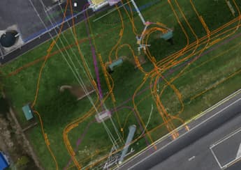
A local power network provider in Pukekohe needed expert service detection and mapping. With multiple high-voltage cables traced and marked out, duct and drainage tracing, water mains tracing and multiple communications cables in the vicinity, the project required our specialist services and expertise.
Read the case study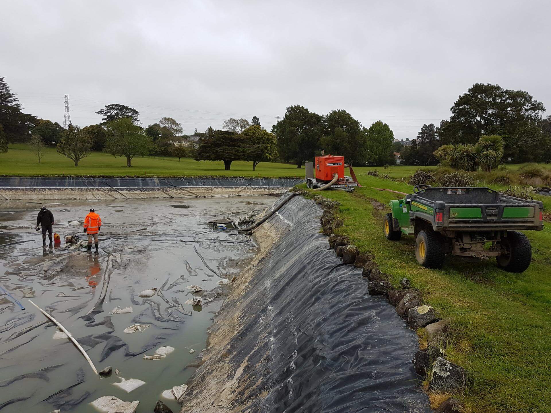
Auckland
Golf Course Pond Leak Detection in Auckland
Lined ponds pose many challenges once underground loss occurs. Utility Works was contracted to assist with the locating of pond leaks at a large Auckland golf course ahead of the dry summer months, when the irrigation system relied on the water supply. The process involved underwater diving and installation of pipe air bags to block the balance pipe and separate the two ponds, enabling accurate loss calculation, followed by GPR and IR works to determine likely areas of loss. The ponds were pumped out to enable locating of the defects for repair. We also assisted with the irrigation flow and isolation testing during the process.
Read the case studyUnderground Service Locating nearby
Underground Service Locating in Drury: your questions
Why does my Drury section stay wet all winter, and how do you tell a leak from groundwater?
Can I trust the as-built plans for the services on my new Drury lot?
Does ground penetrating radar work in Drury's clay?
Ready when you are.
Tell us what you’re seeing or what you’re planning. You’ll get a straight answer, a free quote and one crew that does the whole job.
Mon–Fri 7am–5pm · Waiau Pa, South Auckland · Auckland, Franklin & North Waikato