
Underground Service Locating in East Tāmaki
Local underground service locating for East Tāmaki and the wider East Auckland area
Since 2015Own locators, hydro-vac & diggersAuckland · Franklin · North Waikato
Leak detection and service detection jobs can start from $300 +GST. Every job is different, so call 0800 779 588 and we’ll talk through your situation and give you an estimate.
Underground Service Locating for East Tāmaki properties, sites and farms
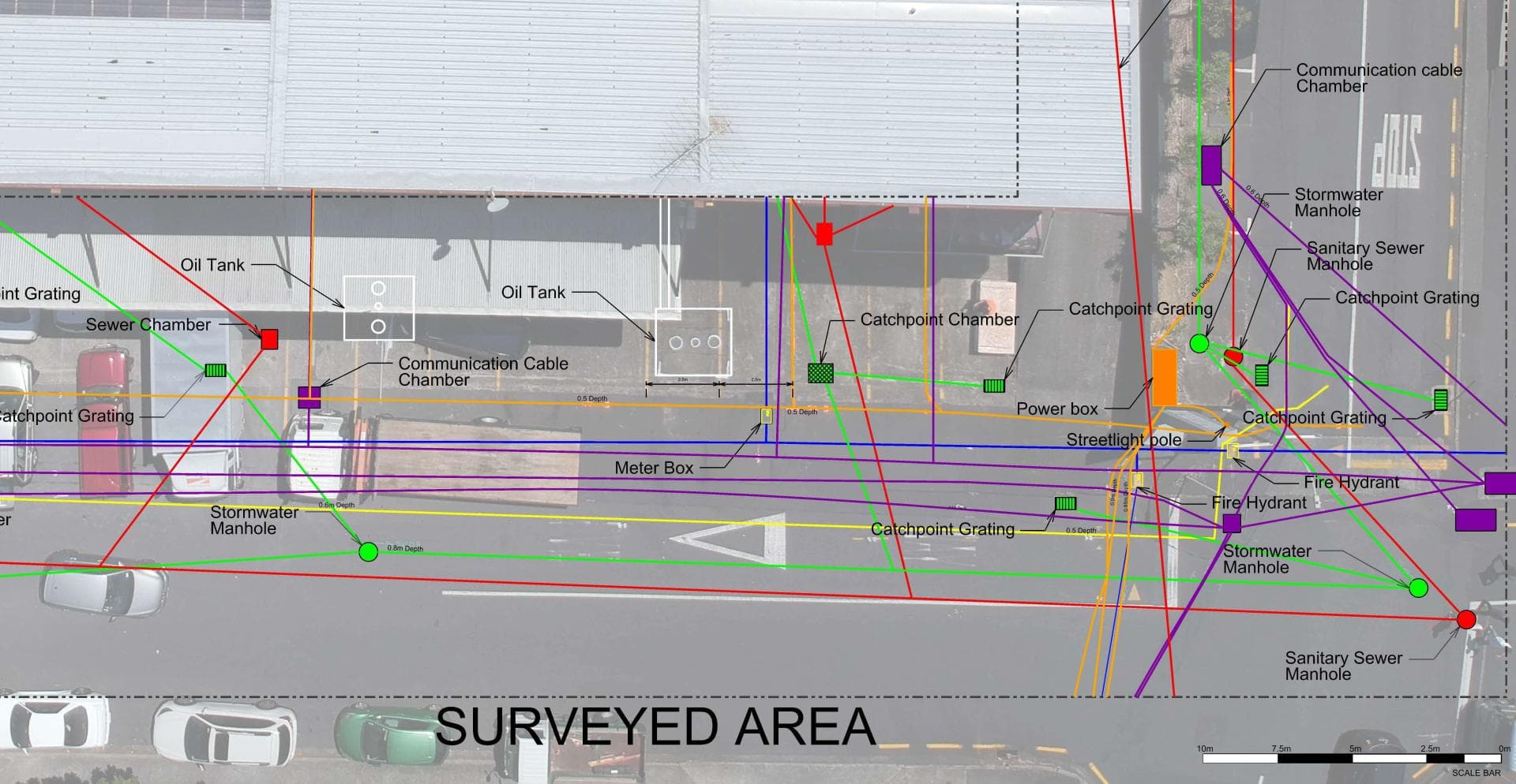
The private networks under East Tāmaki's industrial sites are big: large-diameter water mains, heavy power feeds, fire supplies, process drainage and fibre, laid and extended as buildings were added. Digging into any of it without an accurate locate is an expensive mistake. Utility Works traces and marks services across East Tāmaki sites, confirms depth with hydro-vac potholing, and can record the results with GPS for a site plan that outlasts the paint. Mapping them accurately before any work is what keeps a strike from becoming an expensive mistake.
Typical underground service locating jobs in East Tāmaki
- Locating and mapping private water mains and fire supplies across large industrial properties
- Marking heavy power, fibre and drainage before new canopies, hardstand and building extensions
- Potholing to confirm service depth before directional drilling under busy yards
Underground Service Locating, in short
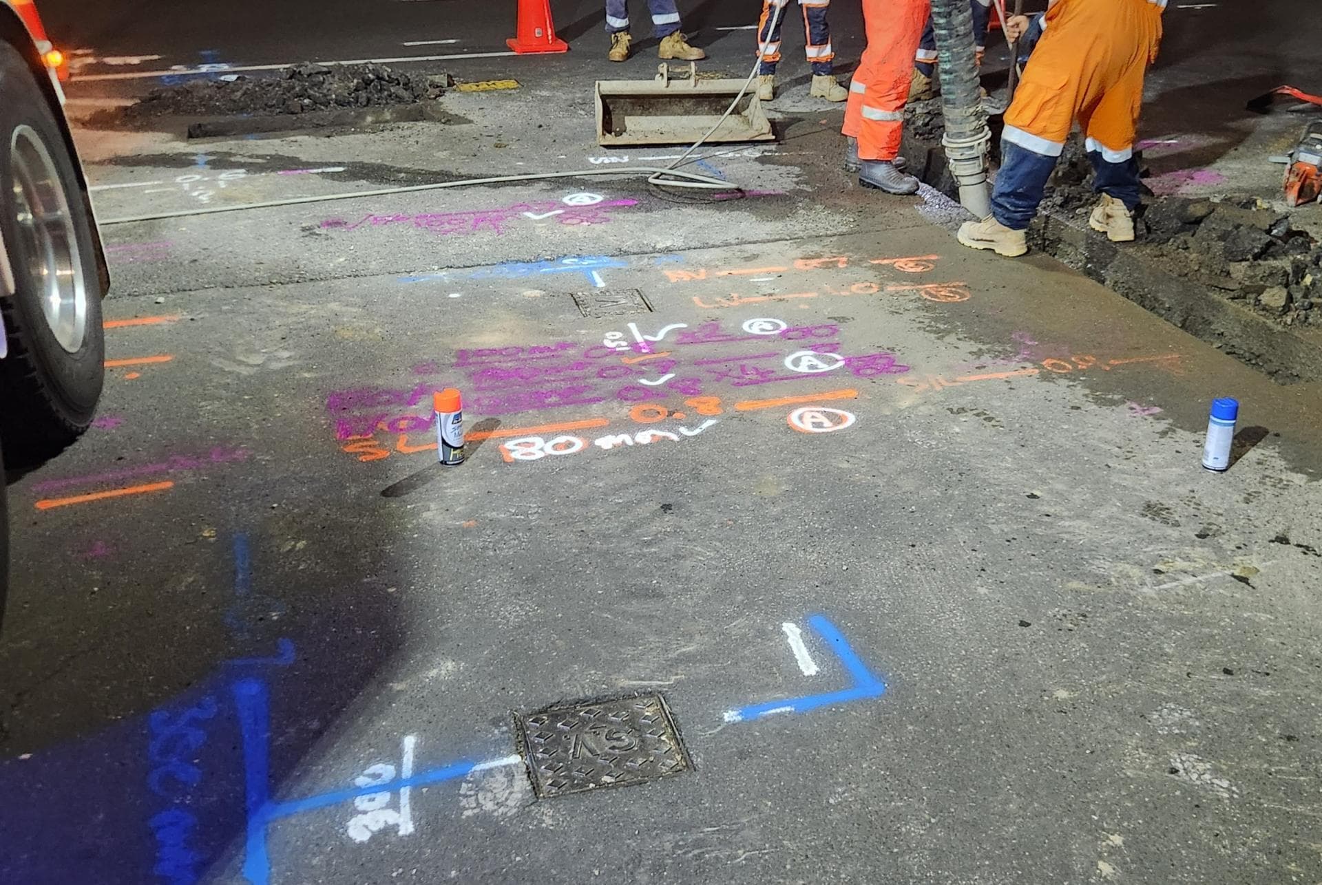
Before anyone digs, we find what is already in the ground: power cables, water and gas pipes, fibre and copper ducts, stormwater and sewer. Electromagnetic locators, tracer equipment, sonde-fitted cameras and ground penetrating radar each pick up what the others cannot, and we mark every service with its depth. Asset owners’ plans from beforeUdig are the starting point; the mark-out shows where things actually are. Where a service must be seen, our hydro-vac truck potholes it without damage, and if the job then needs trenching or a repair the same crew carries on. We can also record what we find with survey-grade GPS for plans and consents.
Full details: Service Location, Detection & Mapping →Working underground in East Tāmaki
East Tāmaki is Auckland's biggest industrial area, a dense grid of manufacturing, warehousing and distribution sites spread between Ōtara, Botany and Flat Bush. Individual properties can run to many hectares, with private water networks that supply production, fire systems and amenities across several buildings.
Water loss on sites that size is measured in hundreds of litres a minute, not drips. Utility Works was engaged on a 14-hectare East Tāmaki property losing more than 170 litres a minute after substantial earlier works had failed to find it; we audited and mapped the mains, isolation tested, then used thermal imaging, GPR and acoustic methods to pinpoint the leak and repair it overnight.
Watercare supplies the area. Most of what we do in East Tāmaki is for facility managers and property owners who need a problem found and fixed with the least possible disruption to a site that runs around the clock, and who want one contractor responsible from investigation through to reinstatement.
When East Tāmaki’s homes were built, and what went in with them
The age of a house tells us what pipe and cable to expect underneath it before we arrive.
Before 1960
East Tāmaki was dairy farms and quarries. Quarrying of Mātanginui, or Greenmount, began around 1870 and had removed most of the hill by the 1960s; Te Puke o Tara was cut down for aggregate mid-century.
1960s to 1980s
The first factories went up on the farmland in the 1960s and 70s as Manukau City pushed industry east of Ōtara, while the land that is now Highbrook was Sir Woolf Fisher's Ra Ora stud. Greenmount's spent quarry was leased in full as a landfill from 1979.
1985 to 2000
The business park era began. The Fisher family drew up plans for Highbrook in 1998, Dannemora's streets went up on the eastern edge through the 1990s, and the landfill fed a gas plant on site by 1992.
Since 2000
Business zoning for Highbrook came in 2001 and its motorway interchange opened in 2007, Botany Town Centre opened on Te Rakau Drive in May 2001, and the Greenmount landfill closed in 2005 and was capped with clean fill through 2016.
What is buried under East Tāmaki’s sections
Underground East Tāmaki is two networks laid a generation apart. The 1960s and 70s factory blocks around Harris Road and Smales Road sit on asbestos-cement water mains with cast iron and AC private fire mains, copper or early PVC service lines and clay or concrete drains. AC breaks at the joints and under loaded hardstand, so on the older sites the leak is almost always a joint or a saddle where a later building was tied in.
Highbrook and the Botany-side developments are the MDPE and PE100 generation, with tracer wire, large-diameter PE ring mains and proper as-builts, though years of fit-outs, canopy extensions and landscaping have moved things and broken fittings the drawings do not know about. Between the two sit 1990s PVC and early MDPE laterals laid without tracer wire, invisible to an electromagnetic locator. On a site built in stages the oldest leak is usually at the point where new pipe met old, so we trace both from their known ends toward the join and pothole the junction before anyone cuts the yard.
What East Tāmaki’s clay and estuary mud means for locating
East Tāmaki has three kinds of ground within a few hundred metres. The ridges are weathered Waitematā Group sandstone and mudstone, the bedrock that gives Howick its clay, broken down near the surface into stiff sandy clay and silt. Toward the Tāmaki River and Ōtara Creek the ground drops onto estuarine flats that stay soft, wet and tidal below the surface. Then there is the volcanic patch: lava from Te Puke o Tara, the maar at Pukewairiki, and the 54-hectare bowl where Greenmount was quarried, used as a landfill until 2005 and refilled with clean fill through 2016.
Clay holds leak water near the pipe but moves it sideways along the trench backfill, so the wet spot on a Harris Road yard is a clue, not a location. On the estuary edge the water joins the tide and nothing shows. GPR reads well through drier clay, basalt and scoria, badly through saturated silt, and gives unreliable pictures over old landfill, where buried metal produces false targets. Clay stands up in a trench but the flats slump and flood, and ground near the former quarry edges can be deep fill, so we pothole first and plan shoring where needed.
Who owns the cables and pipes in East Tāmaki
Which network a service belongs to decides who fixes it, who you call first and whose plans a beforeUdig request returns.
Water supply
Watercare supplies East Tāmaki, with the point of supply at the master meter outlet. On a multi-building site the fire ring main, process water, sub-meters and the pipe to each tenancy are all private.
Wastewater
Watercare runs the sewer and trade-waste network. Larger sites carry private interceptors, process drains and stormwater devices that appear on no public plan.
Electricity
Vector supplies the precinct, inside the old Auckland Electric Power Board area, with heavy underground feeds and private high-voltage runs to switchrooms on the bigger Highbrook and Harris Road sites.
Gas
Vector's gas list names Flat Bush, Howick and Manukau but not East Tāmaki itself; many older factories run gas-fired plant, so we assume a gas main until our locate says otherwise. Anything to do with the gas itself is Vector's work.
Fibre and phone
Chorus built Auckland's UFB fibre and owns the copper beneath it. Vector Fibre's business-only network, 1,700 kilometres concentrated in commercial areas, means two fibre owners can share one East Tāmaki boundary.
beforeUdig plans
A request here returns Watercare, Vector (electricity, gas and fibre), Chorus and Spark plans, and Transpower where its lines cross. They stop at the boundary and show that an asset exists, not where; the private network behind the meter is not on them.
One crew for East Tāmaki: find it, dig it, fix it.
East Tāmaki is about 40 minutes from Waiau Pa via the Southern Motorway and Highbrook, so we quote it as a normal run and can be on site before the morning shift if that suits the plant.
Get a free quoteNeed underground service locating in East Tāmaki? Call us for a free, no-obligation quote.
Free, no-obligation quote · Mon–Fri 7am–5pm · Auckland, Franklin & North Waikato
Google reviews
What customers say
“Prompt service & fair pricing. Tony and his team — sharp eye for detail and out of the box problem solving paired with a high standard of workmanship.”
Richard La Trobe · Google · October 2026
“Really happy with the work to install our underground services. Highly recommend.”
Sarah Walworth · Google · October 2026
“The only company we trust… reliable, cost effective, and honest service from A to Z. 100% confidence in this company.”
Darrel Assink · Google · September 2026
Our Projects
Tuakau, North Waikato
Services Detection & Mapping in Tuakau
A local power network provider in Pukekohe needed expert service detection and mapping. With multiple high-voltage cables traced and marked out, duct and drainage tracing, water mains tracing and multiple communications cables in the vicinity, the project required our specialist services and expertise.
Read the case study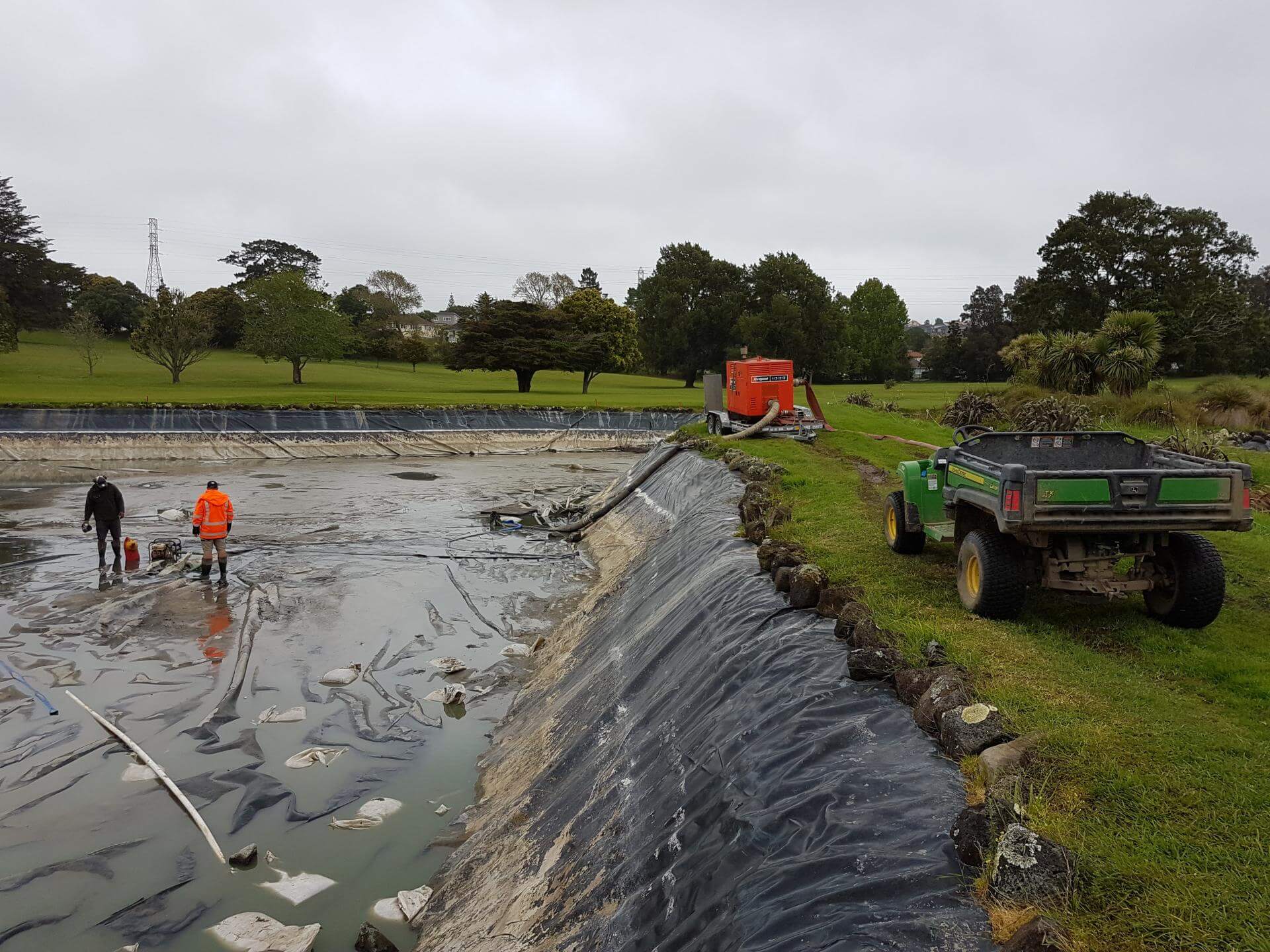
Auckland
Golf Course Pond Leak Detection in Auckland
Lined ponds pose many challenges once underground loss occurs. Utility Works was contracted to assist with the locating of pond leaks at a large Auckland golf course ahead of the dry summer months, when the irrigation system relied on the water supply. The process involved underwater diving and installation of pipe air bags to block the balance pipe and separate the two ponds, enabling accurate loss calculation, followed by GPR and IR works to determine likely areas of loss. The ponds were pumped out to enable locating of the defects for repair. We also assisted with the irrigation flow and isolation testing during the process.
Read the case studyUnderground Service Locating nearby
Other services in East Tāmaki
Underground Service Locating in East Tāmaki: your questions
How do you locate services across a Highbrook site built on the old Ra Ora stud?
Is there landfill or quarry fill under East Tāmaki sites, and does it affect a locate?
Does the Tāmaki estuary edge change how you find a leak?
Ready when you are.
Tell us what you’re seeing or what you’re planning. You’ll get a straight answer, a free quote and one crew that does the whole job.
Mon–Fri 7am–5pm · Waiau Pa, South Auckland · Auckland, Franklin & North Waikato