
Underground Service Locating in Ngāruawāhia
Local underground service locating for Ngāruawāhia and the wider North Waikato & Hamilton area
Since 2015Own locators, hydro-vac & diggersAuckland · Franklin · North Waikato
Leak detection and service detection jobs can start from $300 +GST. Every job is different, so call 0800 779 588 and we’ll talk through your situation and give you an estimate.
Underground Service Locating for Ngāruawāhia properties, sites and farms
Ngāruawāhia's berms hold several generations of services, from the original water and power to more recent fibre, and the new homes going in for Hamilton commuters are adding connections to all of it. Records are patchy, and the soft river-flat ground means services do not always sit where or as deep as expected. Utility Works locates and marks power, water, gas, comms and drainage across Ngāruawāhia sites, uses GPR for the plastic lines, and potholes with hydro-vac before an excavator works near anything live.
Typical underground service locating jobs in Ngāruawāhia
- Locating services before new driveway cuts and connections for infill housing
- Marking power, water and fibre before foundations and retaining walls on new lots
- Finding private lines on rural blocks before sheds, fences and new troughs go in
Underground Service Locating, in short
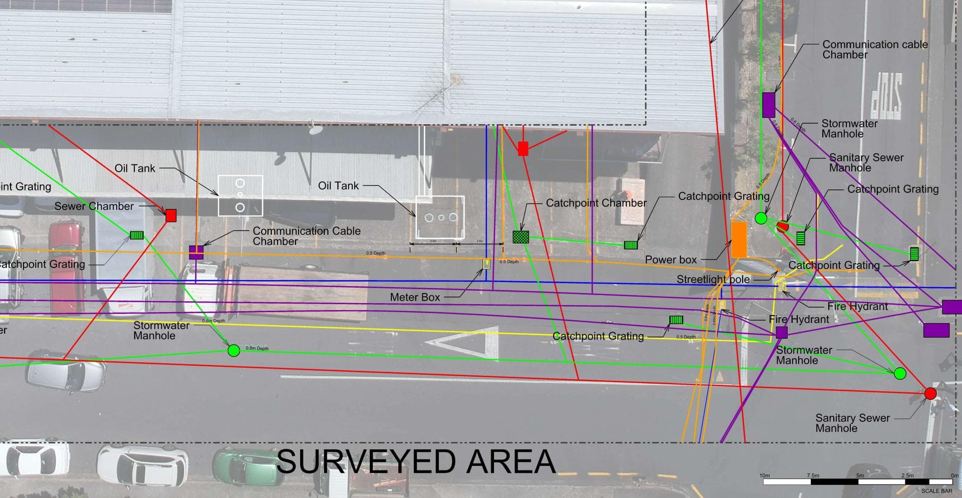
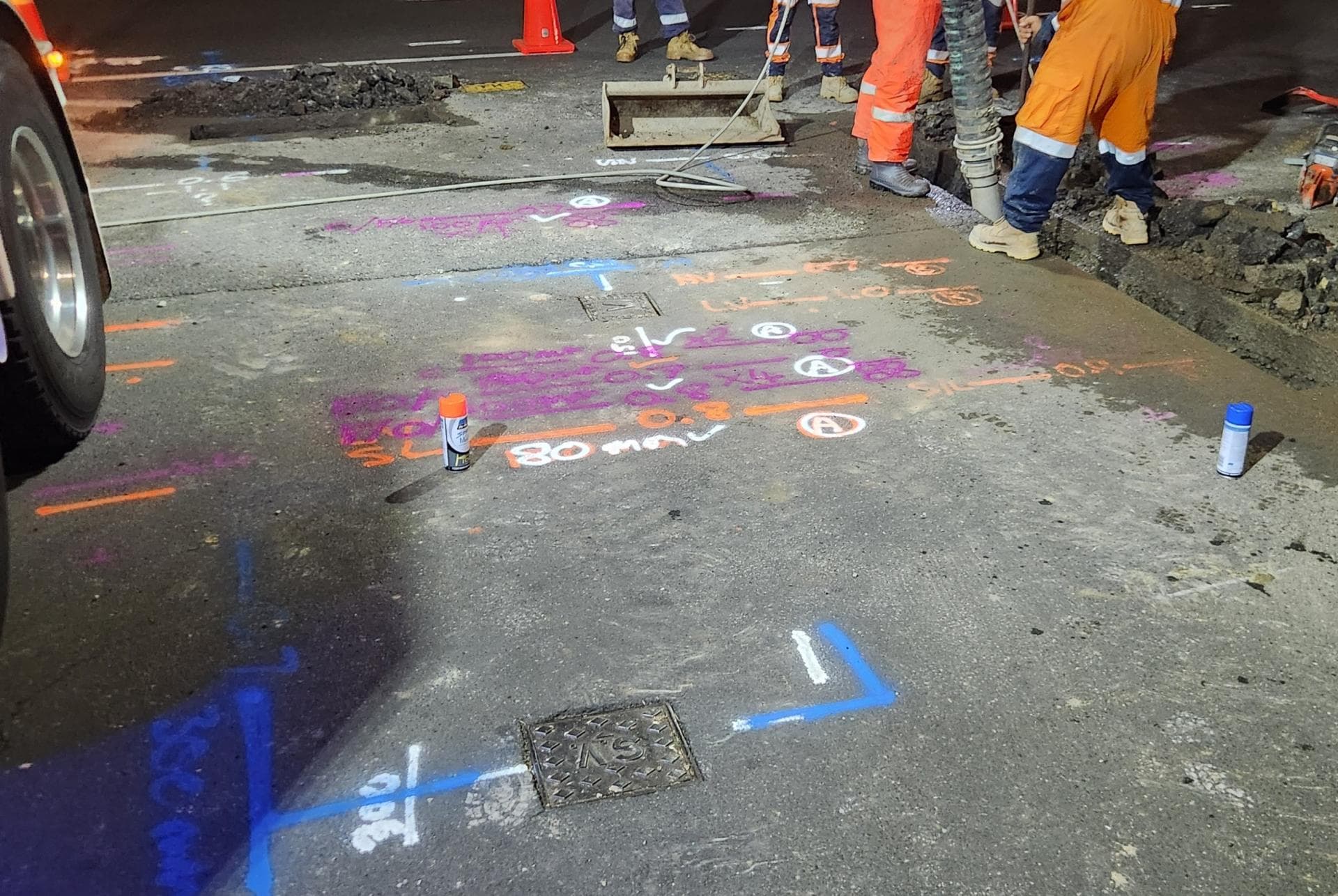
Before anyone digs, we find what is already in the ground: power cables, water and gas pipes, fibre and copper ducts, stormwater and sewer. Electromagnetic locators, tracer equipment, sonde-fitted cameras and ground penetrating radar each pick up what the others cannot, and we mark every service with its depth. Asset owners’ plans from beforeUdig are the starting point; the mark-out shows where things actually are. Where a service must be seen, our hydro-vac truck potholes it without damage, and if the job then needs trenching or a repair the same crew carries on. We can also record what we find with survey-grade GPS for plans and consents.
Full details: Service Location, Detection & Mapping →Working underground in Ngāruawāhia
Ngāruawāhia sits where the Waipā River joins the Waikato, a few minutes north of Hamilton on the old State Highway 1 route. It is a long-established town with much of its housing dating from the middle of last century, and the pipework serving those homes is often of a similar vintage.
The town is growing again as Hamilton commuters look north for more affordable sections, and new homes are being built on the edges and on infill lots. New connections being cut into old mains, and new services going into berms that were never mapped properly, make locating essential before any excavation.
Low-lying ground on the river flats has a high water table, which makes trenches wet and leaks hard to see. Waikato District Council runs water and wastewater in town, while rural properties around Ngāruawāhia rely on bores, river takes and private lines running across paddocks.
When Ngāruawāhia’s homes were built, and what went in with them
The age of a house tells us what pipe and cable to expect underneath it before we arrive.
Before 1960
Pākehā settlement began in 1864 on confiscated land at the river junction, and the grid of streets between the Waikato and the Waipā dates from then. Villas and cottages from the railway and bridge years (road bridge 1921, replaced by the steel truss bridge in 1956) fill the older blocks nearest the confluence and Tūrangawaewae.
1960s to 1980s
Slow, steady building rather than a boom. The weatherboard and brick homes on the flat east of Great South Road are mostly from these decades and make up the bulk of the town's older stock.
1985 to 2000
Little new housing. Ngāruawāhia still had only 5,334 people in 2006, so late-century homes are a few cul-de-sacs rather than whole subdivisions.
Since 2000
The growth years. The expressway bypass opened in December 2013, the population rose 40 per cent between 2013 and 2023 to 7,992 in 2,442 dwellings, and the Galbraith Street infrastructure funded in 2022 is opening up about 200 more homes within walking distance of the town centre.
What is buried under Ngāruawāhia’s sections
Two generations of pipe sit side by side here. Under the older grid it is galvanised steel laterals off cast iron or asbestos-cement mains, with the usual results: rust-choked galvanised that pinholes, and AC that cracks at the joints when the river-flat ground shifts. Copper laterals from the 1960s and 70s last better, but their brass fittings corrode in wet ground and the first sign is often a damp patch at the toby.
The post-2013 houses are on MDPE laterals and PVC or PE mains, often cut into those old mains at a saddle. The weak points are the new fittings, especially where fencing or landscaping went in after the plumber left, and as-builts from fast-built stages that do not match the trench. New plastic without tracer wire is invisible to an electromagnetic locator, so on a 2015 section we go to radar and a hydro-vac pothole, while on a 1950s section the metal pipe traces cleanly from the toby. Where a new connection has been cut into an old AC main, the saddle itself is a common leak point.
What Ngāruawāhia’s river terraces means for locating
The town sits on the flats where the Waipā joins the Waikato, at the foot of the Hakarimata Range. The flats are the northern end of the same volcanic alluvium that underlies Hamilton, spread across the basin about 20,000 years ago when a dam of Taupō ash gave way, so the ground is pumice sand and silt rather than clay. That is good radar ground, and the sand drains well enough that a leak often does surface eventually. The catch is the water table: in the August 2008 flood the river at Ngāruawāhia ran at three times its average flow, and the lowest streets near the confluence have groundwater close to the surface for much of the year.
Away from the rivers the ground rises and digs firmer and drier, so we check which part of town a job is on before we price it, because it changes the shoring and the pumping. The Lower Waikato flood scheme's 255 kilometres of stopbanks start downstream at Huntly, so along the town's own river frontage we assume wet ground and plan the dig around it.
Source: Wikipedia, Hamilton (Hinuera Surface) and Ngāruawāhia; Environment Waikato flood release 2008
Who owns the cables and pipes in Ngāruawāhia
Which network a service belongs to decides who fixes it, who you call first and whose plans a beforeUdig request returns.
Water supply
IAWAI Flowing Waters has run Ngāruawāhia's drinking water and wastewater since 1 July 2026, taking over from Waikato District Council. The town's connections are metered and read every six months. Under the district bylaw the point of supply is the meter and toby at the boundary: IAWAI maintains the service pipe to that point and you maintain the supply pipe beyond it.
Wastewater
IAWAI runs the sewer network in town; lifestyle blocks along the river flats and up the Waipā are on septic tanks.
Electricity
WEL Networks supplies Ngāruawāhia, as it does Hamilton and most of the Waikato District; around half its network is underground.
Gas
We have not confirmed a reticulated natural gas supply in Ngāruawāhia; the Firstgas distribution region covers the Waikato, so check with Firstgas before you assume a berm is gas-free.
Fibre and phone
Ultrafast Fibre, now Tuatahi First Fibre, connected Ngāruawāhia early in its small-town rollout; Chorus still owns the copper.
beforeUdig plans
A beforeUdig request here returns IAWAI, WEL Networks, Tuatahi, Chorus and Firstgas plans for the road reserve. Private laterals, farm lines and the services on new lots laid before the as-built was lodged are not on them.
One crew for Ngāruawāhia: find it, dig it, fix it.
Ngāruawāhia is about 80 minutes from Waiau Pa straight down the expressway, so we quote it as a full day's work, and travel is a small part of the cost on a job of any size.
Get a free quoteNeed underground service locating in Ngāruawāhia? Call us for a free, no-obligation quote.
Free, no-obligation quote · Mon–Fri 7am–5pm · Auckland, Franklin & North Waikato
Google reviews
What customers say
“Prompt service & fair pricing. Tony and his team — sharp eye for detail and out of the box problem solving paired with a high standard of workmanship.”
Richard La Trobe · Google · October 2026
“Really happy with the work to install our underground services. Highly recommend.”
Sarah Walworth · Google · October 2026
“The only company we trust… reliable, cost effective, and honest service from A to Z. 100% confidence in this company.”
Darrel Assink · Google · September 2026
Our Projects
Tuakau, North Waikato
Services Detection & Mapping in Tuakau
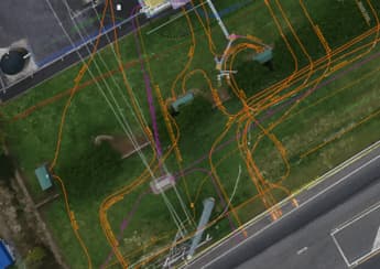
A local power network provider in Pukekohe needed expert service detection and mapping. With multiple high-voltage cables traced and marked out, duct and drainage tracing, water mains tracing and multiple communications cables in the vicinity, the project required our specialist services and expertise.
Read the case study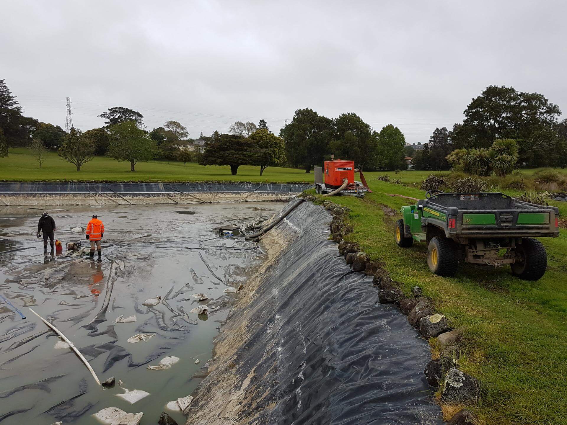
Auckland
Golf Course Pond Leak Detection in Auckland
Lined ponds pose many challenges once underground loss occurs. Utility Works was contracted to assist with the locating of pond leaks at a large Auckland golf course ahead of the dry summer months, when the irrigation system relied on the water supply. The process involved underwater diving and installation of pipe air bags to block the balance pipe and separate the two ponds, enabling accurate loss calculation, followed by GPR and IR works to determine likely areas of loss. The ponds were pumped out to enable locating of the defects for repair. We also assisted with the irrigation flow and isolation testing during the process.
Read the case studyUnderground Service Locating nearby
Other services in Ngāruawāhia
Underground Service Locating in Ngāruawāhia: your questions
My new Ngāruawāhia section has no pipe plans. How do you find the services before I fence or build?
Which fibre company do I call before digging in Ngāruawāhia, Chorus or Tuatahi?
Why do water leaks on the river flats in Ngāruawāhia take so long to show?
Ready when you are.
Tell us what you’re seeing or what you’re planning. You’ll get a straight answer, a free quote and one crew that does the whole job.
Mon–Fri 7am–5pm · Waiau Pa, South Auckland · Auckland, Franklin & North Waikato