
Underground Service Locating in Tuakau
Local underground service locating for Tuakau and the wider North Waikato & Hamilton area
Since 2015Own locators, hydro-vac & diggersAuckland · Franklin · North Waikato
Leak detection and service detection jobs can start from $300 +GST. Every job is different, so call 0800 779 588 and we’ll talk through your situation and give you an estimate.
Underground Service Locating for Tuakau properties, sites and farms
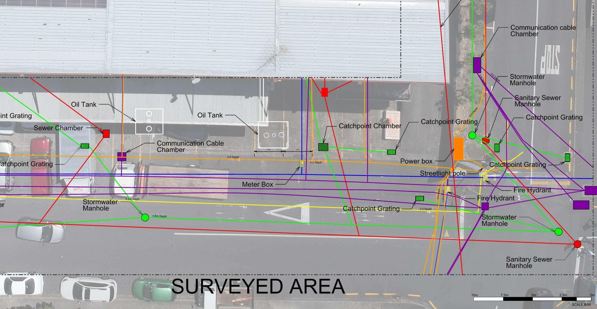
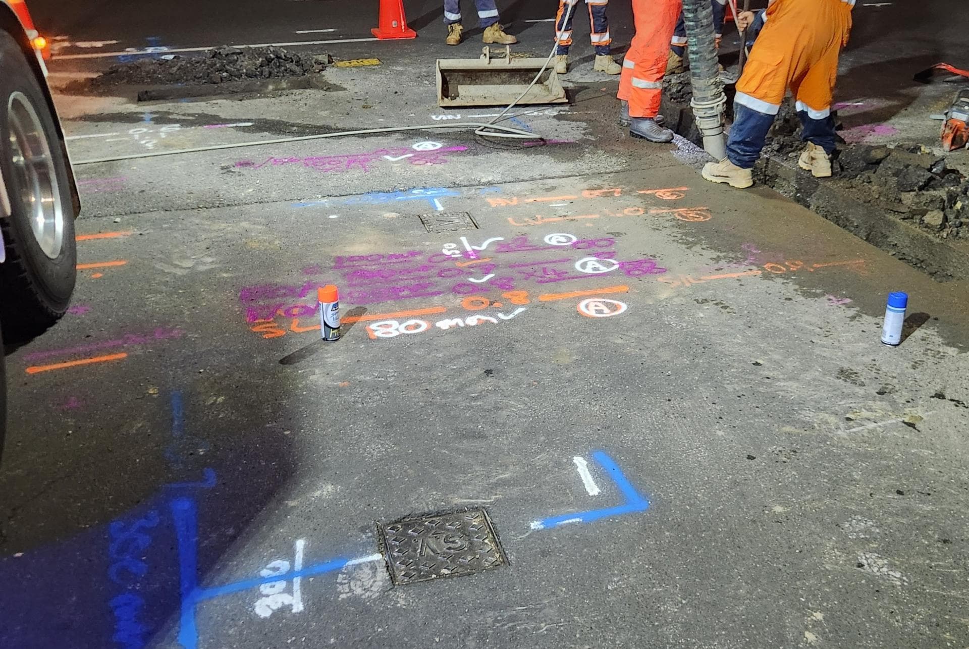
Tuakau is where we have done some of our most detailed detection and mapping work, tracing high-voltage cables, ducts, water mains and communications lines for a network operator across a congested site. The same approach applies to a house section or lifestyle block in Tuakau: find everything, mark it with depth, and pothole anything that has to be confirmed. With Waikato District Council assets in town and private bore and river-take lines in the country, no two Tuakau sites look alike underground.
Typical underground service locating jobs in Tuakau
- Tracing high-voltage and communications cables for network work around Tuakau
- Locating services on lifestyle blocks before new sheds, bores and troughs
- Marking water, power and drainage before house extensions and new driveways
Underground Service Locating, in short
Before anyone digs, we find what is already in the ground: power cables, water and gas pipes, fibre and copper ducts, stormwater and sewer. Electromagnetic locators, tracer equipment, sonde-fitted cameras and ground penetrating radar each pick up what the others cannot, and we mark every service with its depth. Asset owners’ plans from beforeUdig are the starting point; the mark-out shows where things actually are. Where a service must be seen, our hydro-vac truck potholes it without damage, and if the job then needs trenching or a repair the same crew carries on. We can also record what we find with survey-grade GPS for plans and consents.
Full details: Service Location, Detection & Mapping →Working underground in Tuakau
Tuakau is a North Waikato town on the northern bank of the Waikato River, surrounded by dairy farms, horticulture and a growing number of lifestyle blocks. It sits just across the regional boundary from Pukekohe, so we treat it as part of our home patch rather than an outlying area.
The town has a mix of older homes and newer subdivisions, with reticulated water and wastewater managed through Waikato District Council. Rural properties around Tuakau typically run on bores, river takes or tank supply, with long private pipe runs feeding houses, sheds and stock troughs.
Soils here are mostly loam over clay, which makes for reasonable digging but can hide a slow leak for a long time. We work for both network operators and local property owners, and the loam-over-clay ground here is straightforward to read.
When Tuakau’s homes were built, and what went in with them
The age of a house tells us what pipe and cable to expect underneath it before we arrive.
Before 1960
After the 1863 invasion of the Waikato the troops built the Alexandra Redoubt above the river, and the town was laid out about two kilometres inland. The railway arrived in 1875, the present river bridge opened in 1933, and Tuakau became a borough in 1955. The oldest houses are around the station.
1960s to 1980s
Tuakau College opened in 1974 and the Glenbrook mill, open from 1968, drew workers who settled here, so much of the town's housing is 1960s and 70s brick-veneer and weatherboard on the flat streets behind the centre.
1985 to 2000
The borough was merged into Franklin District in 1989 after seven mayors, and growth slowed to infill in town and lifestyle blocks on the farmland around it.
Since 2000
Tuakau moved from Franklin into Waikato District in 2010. The population went from 3,609 in 2006 to 5,736 in 2023, and the council says it could almost double by 2031 under a 30-year structure plan, so the newest subdivisions ring the town.
What is buried under Tuakau’s sections
Tuakau's borough-era streets carry asbestos-cement mains with galvanised and copper laterals, and the galvanised ones are now sixty years old and pinholing under driveways. The 1980s and 90s houses can hide Dux Quest fittings. On the farms and lifestyle blocks the water is private: alkathene from bores and river takes, patched over the years, with no tracer wire. The new subdivisions are MDPE and PVC with tracer wire, laid under Waikato District Council rules.
The thing that makes Tuakau different is the paperwork. The town spent 1989 to 2010 in Franklin District, then moved to Waikato District, and since 1 July 2026 the water network has been run by IAWAI Flowing Waters. A lateral laid in 1995 may be on a Franklin drawing in Auckland Council's archive, a 2015 one on a Waikato drawing, and neither may match the ground. We have mapped power, comms and water across a congested Tuakau site before, and the first job is always to prove what is there rather than trust whichever set of plans turned up.
What Tuakau’s pumice sand and silt means for locating
The GNS Pukekohe geological map, which runs to the lower Waikato River, shows Tuakau on Tauranga Group ground: Pliocene to recent river and shallow-marine sediments, much of it pumiceous sand and silt washed down from the central North Island, lying over older marine sandstone. There is basalt in the mix too, since the South Auckland volcanic field counts a Tuakau Vent among its 82 volcanoes, and where that has weathered the ground turns to clay. Below the town, river flats run down to the Waikato, protected by the Lower Waikato flood scheme and dredged around Tuakau in the past.
Pumice sand drains, so a leak on the terrace drops away rather than surfacing, and an acoustic search along the traced pipe is the only reliable way to find it. Radar works well in that dry sand and poorly in the weathered basalt clay, so we check which one you are on before promising a depth. In pumice sand the trench walls run, and on the flats the water table is close enough to the surface that a trench fills in minutes, which is where the hydro-vac earns its keep.
Who owns the cables and pipes in Tuakau
Which network a service belongs to decides who fixes it, who you call first and whose plans a beforeUdig request returns.
Water supply
Since 1 July 2026 Tuakau's water network has been run by IAWAI Flowing Waters, and the water is still Watercare's Waikato River water from Buckland. Under the Waikato District Water Supply Bylaw 2023 the point of supply is the point on the pipe from the main to your premises; the council side maintains the service pipe to it, you maintain the supply pipe beyond it, and the toby sits under a blue or black cover beside the meter.
Wastewater
Tuakau's sewage is pumped over the regional boundary to Watercare's Pukekohe plant, doubled to 60,000 households in 2023; rural properties are on septic.
Electricity
Counties Energy, whose network runs past Tuakau to Mercer and west of the river to Waikaretu.
Gas
Vector's gas network takes in Tuakau through the Tuakau 2 gas gate, and a high-pressure transmission pipeline crosses the Waikato about three kilometres upstream of the bridge, so river work there needs First Gas's plans.
Fibre and phone
Chorus owns the copper and the UFB fibre, listed as complete.
beforeUdig plans
A request returns Counties Energy, Waikato District Council water and wastewater, Vector Gas, First Gas near the river and Chorus, but not laterals past the toby, farm bore and river-take lines, or pre-2010 work that was never redrawn.
One crew for Tuakau: find it, dig it, fix it.
Tuakau is about 30 minutes from Waiau Pa through Pukekohe, so travel adds little whether the job is in town or on a farm across the river.
Get a free quoteNeed underground service locating in Tuakau? Call us for a free, no-obligation quote.
Free, no-obligation quote · Mon–Fri 7am–5pm · Auckland, Franklin & North Waikato
Google reviews
What customers say
“Prompt service & fair pricing. Tony and his team — sharp eye for detail and out of the box problem solving paired with a high standard of workmanship.”
Richard La Trobe · Google · October 2026
“Really happy with the work to install our underground services. Highly recommend.”
Sarah Walworth · Google · October 2026
“The only company we trust… reliable, cost effective, and honest service from A to Z. 100% confidence in this company.”
Darrel Assink · Google · September 2026
Our Projects
Tuakau, North Waikato
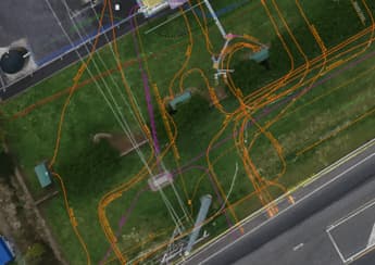
Services Detection & Mapping in Tuakau
A local power network provider in Pukekohe needed expert service detection and mapping. With multiple high-voltage cables traced and marked out, duct and drainage tracing, water mains tracing and multiple communications cables in the vicinity, the project required our specialist services and expertise.
Read the case study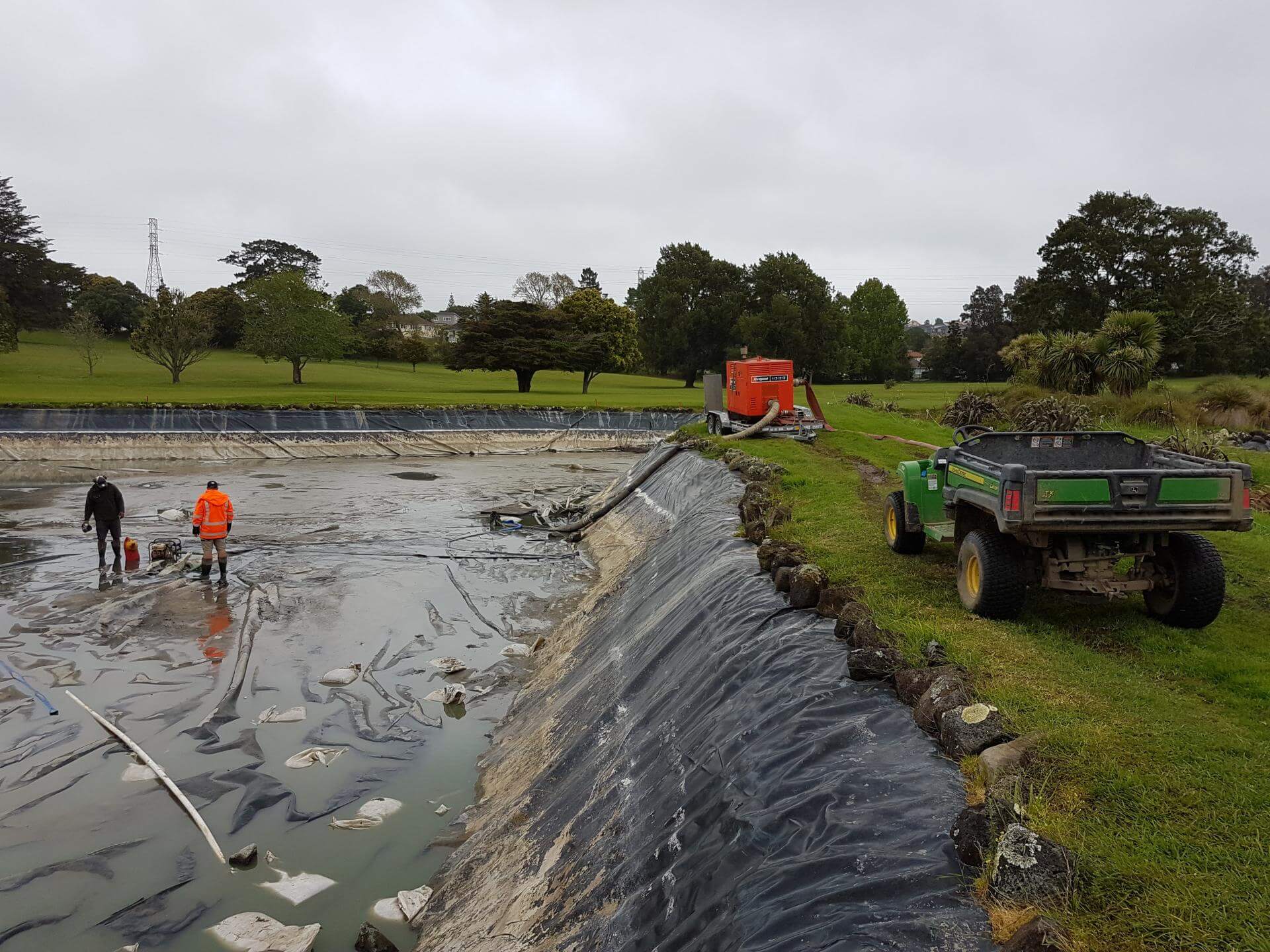
Auckland
Golf Course Pond Leak Detection in Auckland
Lined ponds pose many challenges once underground loss occurs. Utility Works was contracted to assist with the locating of pond leaks at a large Auckland golf course ahead of the dry summer months, when the irrigation system relied on the water supply. The process involved underwater diving and installation of pipe air bags to block the balance pipe and separate the two ponds, enabling accurate loss calculation, followed by GPR and IR works to determine likely areas of loss. The ponds were pumped out to enable locating of the defects for repair. We also assisted with the irrigation flow and isolation testing during the process.
Read the case studyUnderground Service Locating nearby
Underground Service Locating in Tuakau: your questions
Where is the toby on a Tuakau property and who owns it?
My Tuakau property's pipe records are split between Franklin and Waikato. Can you still find the services?
Is there a gas pipeline near Tuakau I should know about before digging?
Ready when you are.
Tell us what you’re seeing or what you’re planning. You’ll get a straight answer, a free quote and one crew that does the whole job.
Mon–Fri 7am–5pm · Waiau Pa, South Auckland · Auckland, Franklin & North Waikato