
Underground Service Locating in Mercer
Local underground service locating for Mercer and the wider North Waikato & Hamilton area
Since 2015Own locators, hydro-vac & diggersAuckland · Franklin · North Waikato
Leak detection and service detection jobs can start from $300 +GST. Every job is different, so call 0800 779 588 and we’ll talk through your situation and give you an estimate.
Underground Service Locating for Mercer properties, sites and farms
There is more in the ground around Mercer than the small settlement suggests. State Highway 1 and the expressway corridor carry trunk services, the river flats have irrigation and stock-water lines, and the farms and lifestyle blocks have decades of private power and water runs that were never drawn. Utility Works locates and marks services on Mercer properties before fencing, drainage, new buildings or roadside work, and we treat every unverified line as live until we have proven otherwise.
Typical underground service locating jobs in Mercer
- Locating private power and water runs before new farm buildings and yards
- Marking services along road boundaries ahead of fencing and culvert work
- Tracing irrigation and stock-water lines on river-flat paddocks before drainage
Underground Service Locating, in short
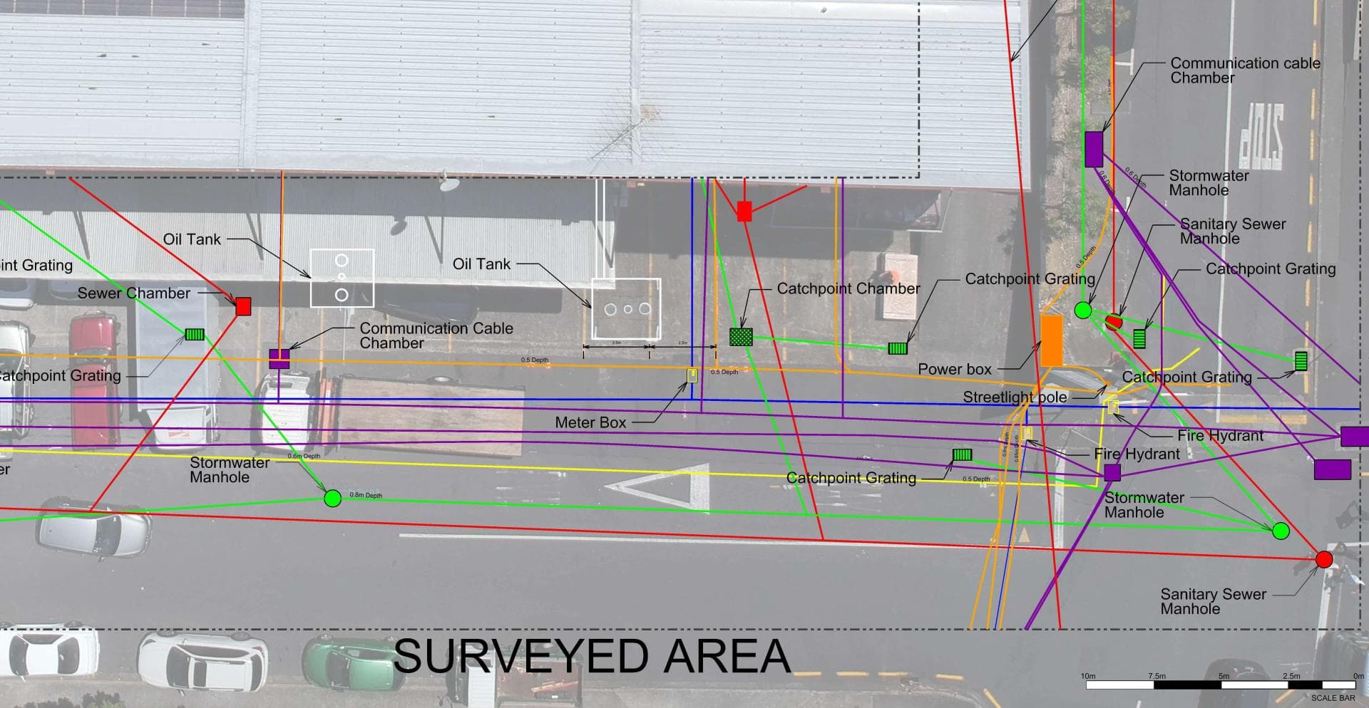
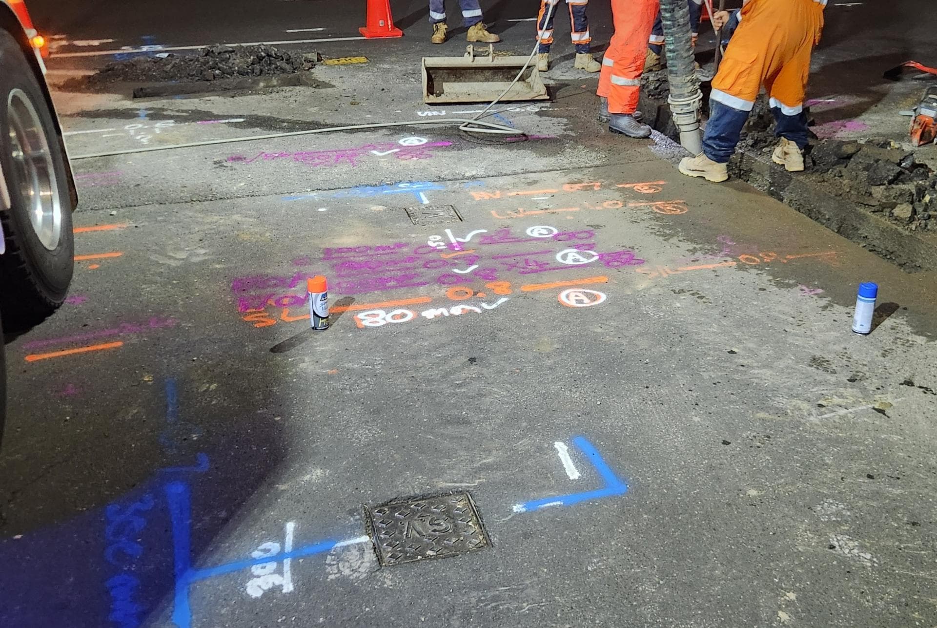
Before anyone digs, we find what is already in the ground: power cables, water and gas pipes, fibre and copper ducts, stormwater and sewer. Electromagnetic locators, tracer equipment, sonde-fitted cameras and ground penetrating radar each pick up what the others cannot, and we mark every service with its depth. Asset owners’ plans from beforeUdig are the starting point; the mark-out shows where things actually are. Where a service must be seen, our hydro-vac truck potholes it without damage, and if the job then needs trenching or a repair the same crew carries on. We can also record what we find with survey-grade GPS for plans and consents.
Full details: Service Location, Detection & Mapping →Working underground in Mercer
Mercer is a small rural settlement on the Waikato River, alongside State Highway 1 and the Waikato Expressway. It is better known as a stop on the road between Auckland and Hamilton than as a town in its own right, with a handful of commercial premises and a scattering of houses, farms and lifestyle blocks.
Most properties around Mercer are rural, running on bores, river takes or tank supply with private pipework that may be decades old. Low-lying land near the river is prone to high groundwater, which makes trenches wet and can mask where a leak is actually coming from.
Reticulated services where they exist are managed by Waikato District Council. Because the settlement is small, we are usually called out for farm and lifestyle block work, roadside service locates and repairs on long rural water lines rather than town mains.
When Mercer’s homes were built, and what went in with them
The age of a house tells us what pipe and cable to expect underneath it before we arrive.
Before 1960
Mercer was a railway town. The main trunk line reached the station on 20 May 1875 and trains stopped for refreshments until 1958, with river steamers working from the landing. The older houses are the railway and river-trade cottages along the old highway, and the Mercer town district was abolished in 1962.
1960s to 1980s
Very little. The Caesar Roose Bridge replaced the ferry in 1972 and the steamers stopped in 1976. Housing from these decades is farmhouses on the surrounding land rather than streets in the village.
1985 to 2000
The station closed in 1986 and the sand-dredging yard shut in 1997, to be redeveloped as the petrol station and food court that give Mercer its service-centre role. No new residential streets.
Since 2000
The 2023 census counted 132 people and 51 dwellings. There is no subdivision growth to speak of; what is being built is on lifestyle blocks in the hills around the village, and that is the honest size of the housing story here.
What is buried under Mercer’s sections
With 51 dwellings there is not much town pipe in Mercer, and what there is dates from the railway era: galvanised laterals and short old mains serving the cottages and the roadside businesses. Nearly all the water pipe around Mercer is private and rural, alkathene from bores and river takes, laid across peat and clay flats and hills over fifty years, joined and patched by successive owners, with no tracer wire and no plan.
The peat is the problem. Drained peat on the flats keeps subsiding, and the regional council's own catchment notes describe ongoing peat subsidence and land-level lowering from drainage. A rigid pipe laid level thirty years ago is now hanging between high spots, pulling joints and fittings apart, so the leaks we find here are at joiners and tees rather than pinholes. Replacement in MDPE, which bends with the ground, is usually the right fix rather than another patch.
What Mercer’s river flats means for locating
Waikato Regional Council's catchment summary for the Waikato at Mercer Bridge East has 62 per cent of the land flat to undulating, and the soils there are gley, poorly drained and clayey, and organic, meaning peat with a naturally high water table that keeps subsiding as it is drained. Rolling land is another 28 per cent, imperfectly drained silty and clayey soils, and the steep remainder is prone to slips. The river has been dredged around Mercer in the past, and the Lower Waikato flood control scheme of stopbanks and pump stations, built from 1961 to 1982, keeps it off the flats.
Leak detection in ground like that is a different job. The paddock is already wet, so leak water does not stand out; we isolate and pressure-test the line and listen along it rather than following the puddles. Radar depth in saturated peat and gley clay is poor, so we use it for shallow targets only and lean on tracing and hydro-vac potholes. Any trench on the flats fills with groundwater within minutes, and the walls in peat will not stand, so the hydro-vac runs as a pump and we keep open trench to a minimum.
Who owns the cables and pipes in Mercer
Which network a service belongs to decides who fixes it, who you call first and whose plans a beforeUdig request returns.
Water supply
Waikato District's water services are run by IAWAI Flowing Waters as of 1 July 2026, but Mercer is not among the supply schemes the council lists, which cover Pōkeno, Tuakau, Meremere, Te Kauwhata and the southern towns. Most Mercer properties are on their own bores, tanks or river takes. Where a metered connection exists, the public side ends at the bylaw's point of supply by the meter and toby.
Wastewater
No reticulated wastewater scheme is listed for Mercer, so houses and businesses are on septic tanks and on-site systems in the same wet ground.
Electricity
Counties Energy's network ends at Mercer: its own description is coast to coast between southern Papakura and Mercer, then west of the river to Waikaretu. Beyond the village you are on another lines company.
Gas
Mercer is not reticulated for natural gas; Vector's network area runs to Tuakau and Pōkeno and stops there; gas here is LPG bottles.
Fibre and phone
Mercer is not on the UFB fibre schedule, so comms is Chorus copper plus wireless.
beforeUdig plans
A request returns Counties Energy, Chorus, NZTA for State Highway 1 and the expressway, Transpower where lines cross, and Waikato District Council. Everything on the farm side of the road boundary is off the plans.
One crew for Mercer: find it, dig it, fix it.
Mercer is about 40 minutes from Waiau Pa by the expressway, so travel adds little to a quote.
Get a free quoteNeed underground service locating in Mercer? Call us for a free, no-obligation quote.
Free, no-obligation quote · Mon–Fri 7am–5pm · Auckland, Franklin & North Waikato
Google reviews
What customers say
“Prompt service & fair pricing. Tony and his team — sharp eye for detail and out of the box problem solving paired with a high standard of workmanship.”
Richard La Trobe · Google · October 2026
“Really happy with the work to install our underground services. Highly recommend.”
Sarah Walworth · Google · October 2026
“The only company we trust… reliable, cost effective, and honest service from A to Z. 100% confidence in this company.”
Darrel Assink · Google · September 2026
Our Projects
Tuakau, North Waikato
Services Detection & Mapping in Tuakau
A local power network provider in Pukekohe needed expert service detection and mapping. With multiple high-voltage cables traced and marked out, duct and drainage tracing, water mains tracing and multiple communications cables in the vicinity, the project required our specialist services and expertise.
Read the case study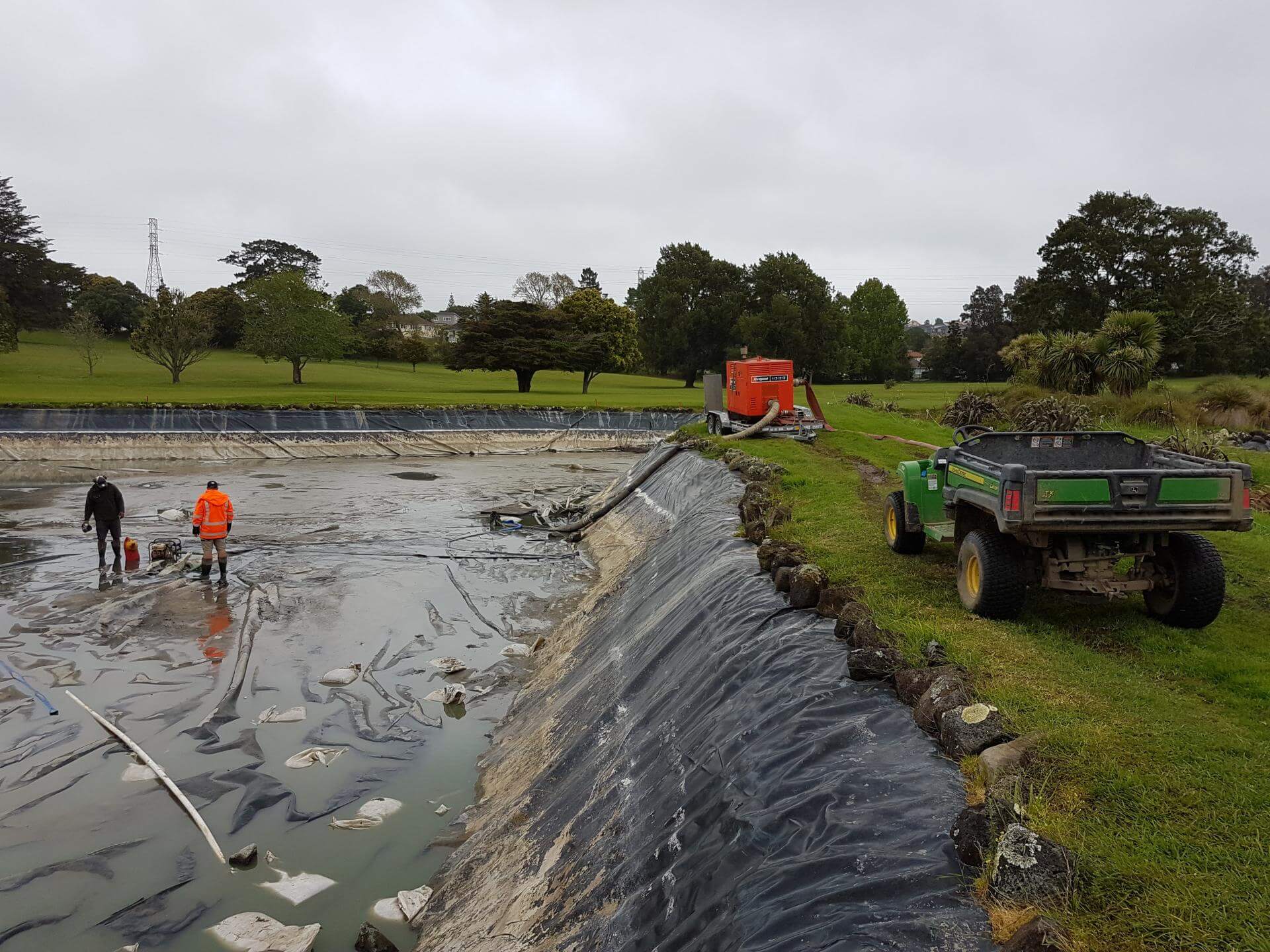
Auckland
Golf Course Pond Leak Detection in Auckland
Lined ponds pose many challenges once underground loss occurs. Utility Works was contracted to assist with the locating of pond leaks at a large Auckland golf course ahead of the dry summer months, when the irrigation system relied on the water supply. The process involved underwater diving and installation of pipe air bags to block the balance pipe and separate the two ponds, enabling accurate loss calculation, followed by GPR and IR works to determine likely areas of loss. The ponds were pumped out to enable locating of the defects for repair. We also assisted with the irrigation flow and isolation testing during the process.
Read the case studyUnderground Service Locating nearby
Underground Service Locating in Mercer: your questions
Will a beforeUdig request show the pipes on my Mercer farm?
Can you locate services on the river flats at Mercer when the ground is waterlogged?
Does peat subsidence break pipes around Mercer?
Ready when you are.
Tell us what you’re seeing or what you’re planning. You’ll get a straight answer, a free quote and one crew that does the whole job.
Mon–Fri 7am–5pm · Waiau Pa, South Auckland · Auckland, Franklin & North Waikato